Earthquake
An earthquake (also known as a quake, tremor or temblor) is the result of a sudden release of energy in the Earth's crust that creates seismic waves. The seismicity, seismism or seismic activity of an area refers to the frequency, type and size of earthquakes experienced over a period of time.
Earthquakes are measured using observations from seismometers. The moment magnitude is the most common scale on which earthquakes larger than approximately 5 are reported for the entire globe. The more numerous earthquakes smaller than magnitude 5 reported by national seismological observatories are measured mostly on the local magnitude scale, also referred to as the Richter scale. These two scales are numerically similar over their range of validity. Magnitude 3 or lower earthquakes are mostly almost imperceptible or weak and magnitude 7 and over potentially cause serious damage over larger areas, depending on their depth. The largest earthquakes in historic times have been of magnitude slightly over 9, although there is no limit to the possible magnitude. The most recent large earthquake of magnitude 9.0 or larger was a 9.0 magnitude earthquake in Japan in 2011 (as of October 2012), and it was the largest Japanese earthquake since records began. Intensity of shaking is measured on the modified Mercalli scale. The shallower an earthquake, the more damage to structures it causes, all else being equal.
At the Earth's surface, earthquakes manifest themselves by shaking and sometimes displacement of the ground. When the epicenter of a large earthquake is located offshore, the seabed may be displaced sufficiently to cause a tsunami. Earthquakes can also trigger landslides, and occasionally volcanic activity.
In its most general sense, the word earthquake is used to describe any seismic event — whether natural or caused by humans — that generates seismic waves. Earthquakes are caused mostly by rupture of geological faults, but also by other events such as volcanic activity, landslides, mine blasts, and nuclear tests. An earthquake's point of initial rupture is called its focus or hypocenter. The epicenter is the point at ground level directly above the hypocenter.
Causes of earthquakes
The earth has four major layers: the inner core, outer core, mantle and crust.The crust and the top of the mantle make up a thin skin on the surface of our planet. But this skin is not all in one piece – it is made up of many pieces like a puzzle covering the surface of the earth. Not only that, but these puzzle pieces keep slowly moving around, sliding past one another and bumping into each other. We call these puzzle pieces tectonic plates, and the edges of the plates are called the plate boundaries. The plate boundaries are made up of many faults, and most of the earthquakes around the world occur on these faults. Since the edges of the plates are rough, they get stuck while the rest of the plate keeps moving. Finally, when the plate has moved far enough, the edges unstick on one of the faults and there is an earthquake.
Earthquakes Caused By Tectonic Plates
The theory of plate tectonics explains how the crust of the Earth is made of several plates, large areas of crust which float on the Mantle. Since these plates are free to slowly move, they can either drift towards each other, away from each other or slide past each other. Many earthquakes happen in areas where plates collide or slide past each other. The Elastic Rebound Theory applies to these quakes.
Major earthquakes are sometimes preceded by a period of changed activity. This might take the form of more frequent minor shocks as the rocks begin to move,called foreshocks , or a period of less frequent shocks as the two rock masses temporarily ‘stick’ and become locked together. Following the main shock, there may be further movements, called aftershocks, which occur as the rock masses settle into their new positions. Aftershocks cause problems for rescue services because they can bring down buildings that were weakened by the main quake.
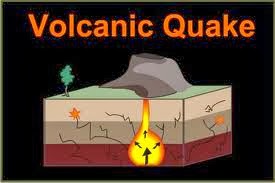
Earthquakes Caused By Volcanoes
Volcanic earthquakes are far less common than tectonic plate related ones. They are triggered by the explosive eruption of a volcano. When a volcano explodes the associated earthquake effects are usually confined to an area 16 to 32 km around its base.
The volcanoes which are most likely to explode violently are those which produce acidic lava. Acidic lava cools and sets very quickly when it contacts air. This chokes the volcano’s vent and blocks the escape of pressure. The only way a blockage can be removed is by the pressure building up until it literally explodes the blockage outward. The volcano will explode in the direction of its weakest point, so it is not always upward. Extraordinary levels of pressure can produce an earthquake of considerable magnitude. The shock waves have been known to produce a series of tsunami in some instances.
Types of earthquakes
Interplate earthquakes occur along the three types of plate boundaries: (1) mid-ocean spreading ridges, (2) subduction zones, and (3) transform faults.
Mid-ocean spreading ridges
Mid-ocean spreading ridges are places in the deep ocean basins where the plates move apart. As the plates separate, hot lava from Earth's mantle rises between them. The lava gradually cools, contracts, and cracks, creating faults. Most of these faults are normal faults. Along the faults, blocks of rock break and slide down away from the ridge, producing earthquakes.
Near the spreading ridges, the plates are thin and weak. The rock has not cooled completely, so it is still somewhat flexible, thus large strains cannot build, and most earthquakes near spreading ridges are shallow.
Subduction zones
Subduction zones are places where two plates collide, and the edge of one plate pushes beneath the edge of the other in a process called subduction. Because of the compression in these zones, many of the faults there are reverse faults. About 80 per cent of major earthquakes occur in subduction zones encircling the Pacific Ocean. In these areas, the plates under the Pacific Ocean are plunging beneath the plates carrying the continents. The grinding of the colder, brittle ocean plates beneath the continental plates creates huge strains that are released in the world's largest earthquakes.
Faults are divided into three main groups. Reverse fault - when two plates collide and one side of the fracture moves on top of another; normal fault -when two plates are moving apart; and strike-slip or lateral - when two plates slide past each other.
In a normal fault, the block of rock on the upper side of the sloping fracture slides down. In a reverse fault, the rock on both sides of the fault is greatly compressed. The compression forces the upper block to slide upward and the lower block to thrust downward. In a strike-slip fault, the fracture extends straight down into the rock, and the blocks of rock along the fault slide past each other horizontally.
As the tectonic plates move about on the asthenosphere, they interact with one another at their boundaries. There are three types of boundaries: (1) divergent, where plates move apart from each other, (2) convergent, where plates move toward each other, and (3) transform, where plates slide alongside each other.
Divergent plate boundaries
Divergent plate boundaries are mostly on ocean floors. There, the separation of plates, or rifting, creates lithosphere.The rifting of the ocean floor enlarges the floor. Magma (liquefied rock) rises from the asthenosphere, filling the gap between the separating plates. The magma hardens, creating equal amounts of new crust on the edges of the two plates. The process of separation of plates and formation of new crust is called sea-floor spreading.
The build-up of ocean crust on plate boundaries generates long underwater mountain ranges called ocean ridges. Some of these mountain ranges occur along the center of ocean basins and are called mid-ocean ridges.
Earthquakes occur at ocean ridges when one plate edge drops down and grinds against the edge of a neighboring plate. These earthquakes occur a short distance beneath the surface of the plates, indicating that newly formed plate edges are very thin.
The rifting of continents creates new seas as ocean waters fill a gap in continental crust.
In the early stages of rifting, the gap is not yet deep enough to become filled with ocean water from the Indian Ocean. However, scientists believe that in 50 million years an extension of that ocean may cut into southeastern Africa.
Convergent plate boundaries
Convergent plate boundaries are places where lithosphere created at divergent boundaries is destroyed by recycling into the mantle. At a convergent boundary, the edge of a plate sinks, thrusting under the margin of its neighboring plate. This process is called subduction. The sinking plate can create deep ocean trenches where it plunges into the asthenosphere. Because Earth is not changing in size, scientists believe that subduction zones consume the same amount of ocean crust as ocean ridges create.
The subducting plates generate powerful earthquakes and usually create a line of volcanoes along the overriding plate boundary. A volcano forms when magma, hot gases, and fragments of rock burst through the surface. Subduction zones generate magma at a depth of about 75 miles (120 kilometers) by melting three kinds of material: oceanic crust at the top of the descending plate, ocean sediment dragged to great depths, and asthenosphere caught in the corner between the converging plates.
At some convergent plate margins, the overriding plate scrapes a thick mass of sediment off the descending plate. This process of subduction accretion (pronounced uh KREE shuhn), adds material to the edge of the overriding plate.
At other convergent plate boundaries, the edge of the descending plate, all its cover of sediment, and even pieces from the edge of the overriding plate disappear beneath the overriding plate. This process, subduction erosion, causes continents to shrink.
At boundaries where plates carrying continents collide, layers of rock in the overriding plate crumple and fold like a tablecloth that is pushed across a table.
Transform plate boundaries
Transform plate boundaries, where plates slide horizontally against each other, neither create nor destroy lithosphere. However, at these boundaries, or transform faults, powerful earthquakes can occur.
Although the tremendous force of tectonic plates grinding against each other is responsible for many earthquakes, we humans can cause them as well.
In some areas, severe earthquake damage is the result of liquefaction of soil. In the right conditions, the violent shaking from an earthquake will make loosely packed sediments and soil behave like a liquid. When a building or house is built on this type of sediment, liquefaction will cause the structure to collapse more easily. Highly developed areas built on loose ground material can suffer severe damage from even a relatively mild earthquake. Liquefaction can also cause severe mudslides.
TYPES OF EARTHQUAKE WAVES
Earthquake shaking and damage is the result of three basic types of elastic waves. Two of the three propagate within a body of rock. The faster of these body waves is called the primary or P wave. Its motion is the same as that of a sound wave in that, as it spreads out, it alternately pushes (compresses) and pulls (dilates) the rock. These P waves are able to travel through both solid rock, such as granite mountains, and liquid material, such as volcanic magma or the water of the oceans.
The slower wave through the body of rock is called the secondary or S wave. As an S wave propagates, it shears the rock sideways at right angles to the direction of travel. If a liquid is sheared sideways or twisted, it will not spring back, hence S waves cannot propagate in the liquid parts of the earth, such as oceans and lakes.
The actual speed of P and S seismic waves depends on the density and elastic properties of the rocks and soil through which they pass. In most earthquakes, the P waves are felt first. The effect is similar to a sonic boom that bumps and rattles windows. Some seconds later, the S waves arrive with their up-and-down and side-to-side motion, shaking the ground surface vertically and horizontally. This is the wave motion that is so damaging to structures.
The third general type of earthquake wave is called a surface wave, reason being is that its motion is restricted to near the ground surface. Such waves correspond to ripples of water that travel across a lake.
Surface waves in earthquakes can be divided into two types. The first is called a Love wave. Its motion is essentially that of S waves that have no vertical displacement; it moves the ground from side to side in a horizontal plane but at right angles to the direction of propagation. The horizontal shaking of Love waves is particuly damaging to the foundations of structures.
The second type of surface wave is known as a Rayleigh wave. Like rolling ocean waves, Rayleigh waves wave move both vertically and horizontally in a vertical plane pointed in the direction in which the waves are travelling.
Surface waves travel more slowly than body waves (P and S); and of the two surface waves, Love waves generally travel faster than Rayleigh waves. Love waves (do not propagate through water) can effect surface water only insofar as the sides of lakes and ocean bays pushing water sideways like the sides of a vibrating tank, whereas Rayleigh waves, becasuse of their vertical component of their motion can affect the bodies of water such as lakes.
P and S waves have a characteristic which effects shaking: when they move through layers of rock in the crust, they are reflected or refracted at the interfaces between rock types. Whenever either wave is refracted or reflected, some of the energy of one type is converted to waves of the other type. A common example; a P wave travels upwards and strikes the bottom of a layer of alluvium, part of its energy will pass upward through the alluvium as a P wave and part will pass upward as the converted S-wave motion. Noting also that part of the energy will also be reflected back downward as P and S waves.
Earthquakes measurements
Earthquakes are recorded by instruments called seismographs. The recording they make is called a seismogram.The seismograph has a base that sets firmly in the ground, and a heavy weight that hangs free. When an earthquake causes the ground to shake, the base of the seismograph shakes too, but the hanging weight does not. Instead the spring or string that it is hanging from absorbs all the movement. The difference in position between the shaking part of the seismograph and the motionless part is what is recorded.
The size of an earthquake depends on the size of the fault and the amount of slip on the fault, but that’s not something scientists can simply measure with a measuring tape since faults are many kilometers deep beneath the earth’s surface. So how do they measure an earthquake? They use the seismogram recordings made on the seismographs at the surface of the earth to determine how large the earthquake was. A short wiggly line that doesn’t wiggle very much means a small earthquake, and a long wiggly line that wiggles a lot means a large earthquake. The length of the wiggle depends on the size of the fault, and the size of the wiggle depends on the amount of slip.
The size of the earthquake is called its magnitude. There is one magnitude for each earthquake. Scientists also talk about the intensity of shaking from an earthquake, and this varies depending on where you are during the earthquake.
Geographical Distribution of Earthquakes
It is true that the earthquakes can happen in any part of the world.But in the areas of faulting and folding or of crustal weakness,the frequency of earthquakes is more than anywhere else.The earthquakes are concentrated in two main belts.
Circum-Pacific Earthquake Belt:This belt includes all the coastal areas around the vast pacific ocean.This belt extends as an isostatically sensitive zone through the coasts of Alaska,Aleutian Islands,Japan,Philippines,New Zealand,North and South America.This zone accounts for 68% of all earthquakes on the surface of the earth.The most talked about earthquake areas in this zone include Japan,Chile,California and Mexico.
Mediterranean-Asia Earthquake Belt:This belt begins from Alps mountain range and passes through Turkey,Caucasus Range,Iran,Iraq,Himalayan mountains and Tibet to China.One of its branches passes through Mongolia and Lake Baikal and another branch extends to Myanmar.About 31% of world's earthquakes are located in this region.
Other Areas:These include Northern Africa and Rift Valley areas of Red Sea and Dead Sea.In addition to these,the ocean ridges are also active earthquake zones.
An earthquake (also known as a quake, tremor or temblor) is the result of a sudden release of energy in the Earth's crust that creates seismic waves. The seismicity, seismism or seismic activity of an area refers to the frequency, type and size of earthquakes experienced over a period of time.
Earthquakes are measured using observations from seismometers. The moment magnitude is the most common scale on which earthquakes larger than approximately 5 are reported for the entire globe. The more numerous earthquakes smaller than magnitude 5 reported by national seismological observatories are measured mostly on the local magnitude scale, also referred to as the Richter scale. These two scales are numerically similar over their range of validity. Magnitude 3 or lower earthquakes are mostly almost imperceptible or weak and magnitude 7 and over potentially cause serious damage over larger areas, depending on their depth. The largest earthquakes in historic times have been of magnitude slightly over 9, although there is no limit to the possible magnitude. The most recent large earthquake of magnitude 9.0 or larger was a 9.0 magnitude earthquake in Japan in 2011 (as of October 2012), and it was the largest Japanese earthquake since records began. Intensity of shaking is measured on the modified Mercalli scale. The shallower an earthquake, the more damage to structures it causes, all else being equal.
At the Earth's surface, earthquakes manifest themselves by shaking and sometimes displacement of the ground. When the epicenter of a large earthquake is located offshore, the seabed may be displaced sufficiently to cause a tsunami. Earthquakes can also trigger landslides, and occasionally volcanic activity.
In its most general sense, the word earthquake is used to describe any seismic event — whether natural or caused by humans — that generates seismic waves. Earthquakes are caused mostly by rupture of geological faults, but also by other events such as volcanic activity, landslides, mine blasts, and nuclear tests. An earthquake's point of initial rupture is called its focus or hypocenter. The epicenter is the point at ground level directly above the hypocenter.
 |
| Earthquakes effects |
The earth has four major layers: the inner core, outer core, mantle and crust.The crust and the top of the mantle make up a thin skin on the surface of our planet. But this skin is not all in one piece – it is made up of many pieces like a puzzle covering the surface of the earth. Not only that, but these puzzle pieces keep slowly moving around, sliding past one another and bumping into each other. We call these puzzle pieces tectonic plates, and the edges of the plates are called the plate boundaries. The plate boundaries are made up of many faults, and most of the earthquakes around the world occur on these faults. Since the edges of the plates are rough, they get stuck while the rest of the plate keeps moving. Finally, when the plate has moved far enough, the edges unstick on one of the faults and there is an earthquake.
 |
| earth layers |
Earthquakes Caused By Tectonic Plates
The theory of plate tectonics explains how the crust of the Earth is made of several plates, large areas of crust which float on the Mantle. Since these plates are free to slowly move, they can either drift towards each other, away from each other or slide past each other. Many earthquakes happen in areas where plates collide or slide past each other. The Elastic Rebound Theory applies to these quakes.
Major earthquakes are sometimes preceded by a period of changed activity. This might take the form of more frequent minor shocks as the rocks begin to move,called foreshocks , or a period of less frequent shocks as the two rock masses temporarily ‘stick’ and become locked together. Following the main shock, there may be further movements, called aftershocks, which occur as the rock masses settle into their new positions. Aftershocks cause problems for rescue services because they can bring down buildings that were weakened by the main quake.
Earthquakes Caused By Volcanoes
Volcanic earthquakes are far less common than tectonic plate related ones. They are triggered by the explosive eruption of a volcano. When a volcano explodes the associated earthquake effects are usually confined to an area 16 to 32 km around its base.
The volcanoes which are most likely to explode violently are those which produce acidic lava. Acidic lava cools and sets very quickly when it contacts air. This chokes the volcano’s vent and blocks the escape of pressure. The only way a blockage can be removed is by the pressure building up until it literally explodes the blockage outward. The volcano will explode in the direction of its weakest point, so it is not always upward. Extraordinary levels of pressure can produce an earthquake of considerable magnitude. The shock waves have been known to produce a series of tsunami in some instances.
Types of earthquakes
Interplate earthquakes occur along the three types of plate boundaries: (1) mid-ocean spreading ridges, (2) subduction zones, and (3) transform faults.
Mid-ocean spreading ridges
Mid-ocean spreading ridges are places in the deep ocean basins where the plates move apart. As the plates separate, hot lava from Earth's mantle rises between them. The lava gradually cools, contracts, and cracks, creating faults. Most of these faults are normal faults. Along the faults, blocks of rock break and slide down away from the ridge, producing earthquakes.
Near the spreading ridges, the plates are thin and weak. The rock has not cooled completely, so it is still somewhat flexible, thus large strains cannot build, and most earthquakes near spreading ridges are shallow.
 |
| mid ocean ridge spreeing |
Subduction zones are places where two plates collide, and the edge of one plate pushes beneath the edge of the other in a process called subduction. Because of the compression in these zones, many of the faults there are reverse faults. About 80 per cent of major earthquakes occur in subduction zones encircling the Pacific Ocean. In these areas, the plates under the Pacific Ocean are plunging beneath the plates carrying the continents. The grinding of the colder, brittle ocean plates beneath the continental plates creates huge strains that are released in the world's largest earthquakes.
Faults are divided into three main groups. Reverse fault - when two plates collide and one side of the fracture moves on top of another; normal fault -when two plates are moving apart; and strike-slip or lateral - when two plates slide past each other.
In a normal fault, the block of rock on the upper side of the sloping fracture slides down. In a reverse fault, the rock on both sides of the fault is greatly compressed. The compression forces the upper block to slide upward and the lower block to thrust downward. In a strike-slip fault, the fracture extends straight down into the rock, and the blocks of rock along the fault slide past each other horizontally.
As the tectonic plates move about on the asthenosphere, they interact with one another at their boundaries. There are three types of boundaries: (1) divergent, where plates move apart from each other, (2) convergent, where plates move toward each other, and (3) transform, where plates slide alongside each other.
Divergent plate boundaries
Divergent plate boundaries are mostly on ocean floors. There, the separation of plates, or rifting, creates lithosphere.The rifting of the ocean floor enlarges the floor. Magma (liquefied rock) rises from the asthenosphere, filling the gap between the separating plates. The magma hardens, creating equal amounts of new crust on the edges of the two plates. The process of separation of plates and formation of new crust is called sea-floor spreading.
The build-up of ocean crust on plate boundaries generates long underwater mountain ranges called ocean ridges. Some of these mountain ranges occur along the center of ocean basins and are called mid-ocean ridges.
Earthquakes occur at ocean ridges when one plate edge drops down and grinds against the edge of a neighboring plate. These earthquakes occur a short distance beneath the surface of the plates, indicating that newly formed plate edges are very thin.
The rifting of continents creates new seas as ocean waters fill a gap in continental crust.
In the early stages of rifting, the gap is not yet deep enough to become filled with ocean water from the Indian Ocean. However, scientists believe that in 50 million years an extension of that ocean may cut into southeastern Africa.
Convergent plate boundaries
Convergent plate boundaries are places where lithosphere created at divergent boundaries is destroyed by recycling into the mantle. At a convergent boundary, the edge of a plate sinks, thrusting under the margin of its neighboring plate. This process is called subduction. The sinking plate can create deep ocean trenches where it plunges into the asthenosphere. Because Earth is not changing in size, scientists believe that subduction zones consume the same amount of ocean crust as ocean ridges create.
The subducting plates generate powerful earthquakes and usually create a line of volcanoes along the overriding plate boundary. A volcano forms when magma, hot gases, and fragments of rock burst through the surface. Subduction zones generate magma at a depth of about 75 miles (120 kilometers) by melting three kinds of material: oceanic crust at the top of the descending plate, ocean sediment dragged to great depths, and asthenosphere caught in the corner between the converging plates.
At some convergent plate margins, the overriding plate scrapes a thick mass of sediment off the descending plate. This process of subduction accretion (pronounced uh KREE shuhn), adds material to the edge of the overriding plate.
At other convergent plate boundaries, the edge of the descending plate, all its cover of sediment, and even pieces from the edge of the overriding plate disappear beneath the overriding plate. This process, subduction erosion, causes continents to shrink.
At boundaries where plates carrying continents collide, layers of rock in the overriding plate crumple and fold like a tablecloth that is pushed across a table.
Transform plate boundaries
Transform plate boundaries, where plates slide horizontally against each other, neither create nor destroy lithosphere. However, at these boundaries, or transform faults, powerful earthquakes can occur.
Although the tremendous force of tectonic plates grinding against each other is responsible for many earthquakes, we humans can cause them as well.
In some areas, severe earthquake damage is the result of liquefaction of soil. In the right conditions, the violent shaking from an earthquake will make loosely packed sediments and soil behave like a liquid. When a building or house is built on this type of sediment, liquefaction will cause the structure to collapse more easily. Highly developed areas built on loose ground material can suffer severe damage from even a relatively mild earthquake. Liquefaction can also cause severe mudslides.
 |
| Transform fault |
TYPES OF EARTHQUAKE WAVES
Earthquake shaking and damage is the result of three basic types of elastic waves. Two of the three propagate within a body of rock. The faster of these body waves is called the primary or P wave. Its motion is the same as that of a sound wave in that, as it spreads out, it alternately pushes (compresses) and pulls (dilates) the rock. These P waves are able to travel through both solid rock, such as granite mountains, and liquid material, such as volcanic magma or the water of the oceans.
 |
| primary wave |
The slower wave through the body of rock is called the secondary or S wave. As an S wave propagates, it shears the rock sideways at right angles to the direction of travel. If a liquid is sheared sideways or twisted, it will not spring back, hence S waves cannot propagate in the liquid parts of the earth, such as oceans and lakes.
 |
| S-wave |
The actual speed of P and S seismic waves depends on the density and elastic properties of the rocks and soil through which they pass. In most earthquakes, the P waves are felt first. The effect is similar to a sonic boom that bumps and rattles windows. Some seconds later, the S waves arrive with their up-and-down and side-to-side motion, shaking the ground surface vertically and horizontally. This is the wave motion that is so damaging to structures.
The third general type of earthquake wave is called a surface wave, reason being is that its motion is restricted to near the ground surface. Such waves correspond to ripples of water that travel across a lake.
Surface waves in earthquakes can be divided into two types. The first is called a Love wave. Its motion is essentially that of S waves that have no vertical displacement; it moves the ground from side to side in a horizontal plane but at right angles to the direction of propagation. The horizontal shaking of Love waves is particuly damaging to the foundations of structures.
 |
| Love wave |
The second type of surface wave is known as a Rayleigh wave. Like rolling ocean waves, Rayleigh waves wave move both vertically and horizontally in a vertical plane pointed in the direction in which the waves are travelling.
 |
| Rayleigh wave |
Surface waves travel more slowly than body waves (P and S); and of the two surface waves, Love waves generally travel faster than Rayleigh waves. Love waves (do not propagate through water) can effect surface water only insofar as the sides of lakes and ocean bays pushing water sideways like the sides of a vibrating tank, whereas Rayleigh waves, becasuse of their vertical component of their motion can affect the bodies of water such as lakes.
P and S waves have a characteristic which effects shaking: when they move through layers of rock in the crust, they are reflected or refracted at the interfaces between rock types. Whenever either wave is refracted or reflected, some of the energy of one type is converted to waves of the other type. A common example; a P wave travels upwards and strikes the bottom of a layer of alluvium, part of its energy will pass upward through the alluvium as a P wave and part will pass upward as the converted S-wave motion. Noting also that part of the energy will also be reflected back downward as P and S waves.
Earthquakes measurements
Earthquakes are recorded by instruments called seismographs. The recording they make is called a seismogram.The seismograph has a base that sets firmly in the ground, and a heavy weight that hangs free. When an earthquake causes the ground to shake, the base of the seismograph shakes too, but the hanging weight does not. Instead the spring or string that it is hanging from absorbs all the movement. The difference in position between the shaking part of the seismograph and the motionless part is what is recorded.
 |
| seismograph |
The size of the earthquake is called its magnitude. There is one magnitude for each earthquake. Scientists also talk about the intensity of shaking from an earthquake, and this varies depending on where you are during the earthquake.
 |
| Wave amplitude |
It is true that the earthquakes can happen in any part of the world.But in the areas of faulting and folding or of crustal weakness,the frequency of earthquakes is more than anywhere else.The earthquakes are concentrated in two main belts.
Circum-Pacific Earthquake Belt:This belt includes all the coastal areas around the vast pacific ocean.This belt extends as an isostatically sensitive zone through the coasts of Alaska,Aleutian Islands,Japan,Philippines,New Zealand,North and South America.This zone accounts for 68% of all earthquakes on the surface of the earth.The most talked about earthquake areas in this zone include Japan,Chile,California and Mexico.
Mediterranean-Asia Earthquake Belt:This belt begins from Alps mountain range and passes through Turkey,Caucasus Range,Iran,Iraq,Himalayan mountains and Tibet to China.One of its branches passes through Mongolia and Lake Baikal and another branch extends to Myanmar.About 31% of world's earthquakes are located in this region.
Other Areas:These include Northern Africa and Rift Valley areas of Red Sea and Dead Sea.In addition to these,the ocean ridges are also active earthquake zones.
 |
| Earthquakes distribution |